12
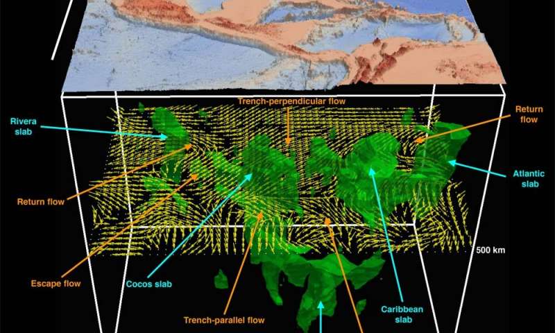
Geoscientists recently used massive amounts of earthquake data and supercomputers to generate high-resolution, 3D images of the dynamic geological processes taking place far below the Earth’s surface. The research team described how it created images of mantle flows in a subduction region under Central America and the Caribbean Sea.